

Downtown Campus
The downtown campus comprises more than 100 buildings on approximately 32 hectares of land, at the foot of Mount Royal. Developed around what was originally the private estate of James McGill, a Scottish merchant, the campus grew to its current size over 200 years. The campus serves as a green oasis in the middle of downtown Montreal and its buildings offer a fascinating range of architectural styles.
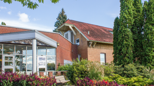
Macdonald Campus
Macdonald Campus consists of 650 hectares of land in Sainte-Anne-de-Bellevue, on the western tip of the island of Montreal. With 70 buildings and 12 km of roads, it is the largest private land holding in the region. It is home to McGill's Faculty of Agricultural and Environmental Sciences, which, among its many activities, operates a horticultural research centre and a dairy farm.
Visit the Macdonald Campus website.
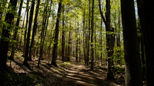
Gault Nature Reserve
Situated at Mont Saint-Hilaire, approximately 40 km from Montreal, McGill’s Gault Nature Reserve is a private reserve that protects nearly 1,000 hectares of natural environment. Natural science research and teaching take place at the reserve and its 25 km trail network is open year-round to visitors.
Visit the Gault Nature Reserve website.
Photo by Alex Tran.
Campus maps for printing

The McGill campus maps are updated regularly. Different formats are available to print:
- Easy-to-print visitors maps (8.5”x11”, black and white),
- Large public wayfinding maps for interior and exterior displays (poster sized, full colour),
- Site plans (A0 poster size, full colour).
Maps of construction projects
The maps of construction projects show ongoing and upcoming construction projects on the downtown and Macdonald campuses. The maps are updated as projects advance so you are invited to check back regularly for up-to-date information.
Please check with your Building Director for more information on the projects happening or planned in your building.

Building and floor plans
Current members of the McGill community may request geospatial data from Campus Planning and Development. You can submit your request using the webform.
We only supply floor plans. We do not have sectionals/elevations of buildings.
CPD does not charge for this service and as such will not create new datasets.
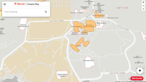
Interactive maps
The interactive campus maps of downtown, Macdonald, and the Gault Reserve are intended to provide an intuitive means of wayfinding at McGill University.
If you have comments or inquiries about the maps or geospatial data, please email campusmaps [at] mcgill.ca.