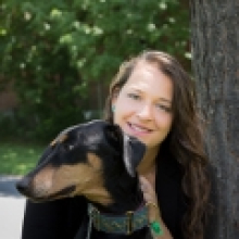
Margaret Kalacska

I am an Associate Professor in the Department of Geography at McGill University. My current research contributes to the advancement of remote sensing applications in environmental science and natural hazard monitoring and response.
In my lab we extensively use Remotely Piloted Aircraft Systems (RPAS), and airborne hyperspectral remote sensing from manned aircraft. We also work with satellite imagery (e.g. PlanetScope, Landsat, Sentinel-2), LiDAR and thermal imaging for detailed investigations of terrestrial and aquatic ecosystems, natural hazards (e.g., wildfires, volcanoes) and infrastructure. We are a world leader in RPAS hyperspectral imaging.
In collaboration with the National Research Council of Canada's Flight Research Laboratory we developed the second fully operational RPAS-HSI system in the world. This system has been in use for the Canadian Airborne Biodiversity Observatory (CABO) since 2018 to estimate biodiversity and ecosystem functioning. We are currently working on an exciting new custom heavy lift RPAS specifically for hyperspectral imaging to be unveiled in the spring 2023!
Through the Fish + Forest project we study aquatic habitats of endemic and endangered ichthyofauna, producing the first aerial and underwater 3D reconstructions of riverscapes in Brazil. Our research also examines large-scale land use change for biodiversity conservation from satellite imagery and contribute to satellite data product validation (Landsat 8 OLI and Sentinel-2) for Canadian peatlands.
I was the first Canadian woman to lead an airborne hyperspectral mission (MAC-13) in Costa Rica in 2013 for forest carbon stock and biodiversity estimation. My interdisciplinary research is carried out in Canada, Brazil, Tanzania, Ghana, Peruvian Amazon, Panama, Madagascar and Costa Rica.
In 2014, I was awarded the Fessenden Prize for Science Innovation by McGill University and in 2018, the Silver Medal from the Canadian Remote Sensing Society, the highest mid-career achievement award recognizing excellence in remote sensing in Canada. I was nominated by the National Research Council Canada for the 2020 Steacie Prize in Natural Sciences.
- PhD Earth and Atmospheric Sciences, University of Alberta (2006)
- MSc Earth and Atmospheric Sciences, University of Alberta (2004)
- Kalacska M., Arroyo-Mora J.P., Lucanus O. Comparing UAS LiDAR and Structure-from-Motion Photogrammetry for Peatland Mapping and Virtual Reality (VR) Visualization 2021 Drones 5(2), 36 https://www.mdpi.com/2504-446X/5/2/36/htm
- Kolmann M, Kalacska M., Lucanus O, Sousa L, Wainwright D, Arroyo-Mora J.P., Andrade M. Hyperspectral data as a biodiversity screening tool can differentiate among diverse Neotropical fishes. 2021 Scientific Reports 11:16157 https://www.nature.com/articles/s41598-021-95713-0
- Rowan G.S.L, Kalacska M. A review of remote sensing of submerged aquatic vegetation for non-specialists. 2021 Remote Sensing 13(4):623 https://www.mdpi.com/2072-4292/13/4/623/htm
- Arroyo-Mora J.P., Kalacska M., Løke T., Schläpfer D., Coops N.C., Lucanus O., Leblanc G. Assessing the impact of illumination on UAV pushbroom hyperspectral imagery collected under various cloud cover conditions 2021 Remote Sensing of Environment 258:112396 https://www.sciencedirect.com/science/article/pii/S0034425721001140#f0045
- Inamdar D., Kalacska M., Arroyo-Mora J.P., Leblanc G. The Directly-Georeferenced Hyperspectral Point Cloud: Preserving the Integrity of Hyperspectral Imaging Data 2021 Frontiers in Remote Sensing 2:675323 https://www.frontiersin.org/articles/10.3389/frsen.2021.675323/full
- Sousa L, Lucanus O, Arroyo-Mora J.P, Kalacska M. Conservation and trade of the endangered Hypancistrus zebra (Siluriformes, Loricariidae), one of the most trafficked Brazilian fish. 2021 Global Ecology and Conservation 27:e01570 https://www.sciencedirect.com/science/article/pii/S2351989421001207
- Osei Darko P, Kalacska M, Arroyo-Mora J.P., Fagan M E. Spectral complexity of hyperspectral images: A new approach for mangrove classification. 2021 Remote Sensing 13(13):2604 https://www.mdpi.com/2072-4292/13/13/2604/htm
- Elmer K, Kalacska M. A High-Accuracy GNSS Dataset of Ground Truth Points Collected within Îles-de-Boucherville National Park, Quebec, Canada. 2021 Data 6(3), 32 https://www.mdpi.com/2306-5729/6/3/32/htm
- Lucanus O, Kalacska M, Arroyo-Mora JP, Sousa L, Nobre Carvalho L. Before and after: A multiscale remote sensing assessment of the Sinop dam, Mato Grosso, Brazil. 2021 Earth 2(2):303-330 https://www.mdpi.com/2673-4834/2/2/18/htm