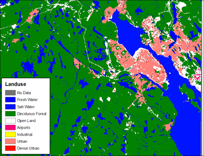
Clutter Data produced by DMTI Spatial Inc., is a digital landuse file at 30 metre resolution. The data was captured from the 1:50 000 National Topographic Database maps. The 11 landuse categories are: Freshwater, Ocean, Coniferous Forest, Deciduous Forest, Open Land, Airports, Industrial, Urban, Dense Urban, Core Urban, and Wetland. All classifications may not necessarily be present for a given geographic area, due to the variations in the physical land characteristics across the country. The clutter data can be used in conjunction with the Digital Elevation Model dataset produced by DMTI Spatial Inc..
Access
Members of the McGill Community can obtain copies of the data by filling out the Geospatial Data Request Form . Please indicate the desired NTS number (Example: 31H12 or 42A10). NTS numbers can be obtained by consulting the NTS Map Indexes below.
Metadata
| Title | Clutter Data |
| Author | DMTI Spatial |
| Date | Current to NTDB datasets |
| Coverage | Clutter Data 90m Index Clutter Data 30m index |
| Language | English |
| Format | ASCII Text |
| Projection | Geographic |
| Datum | NAD83 |
| User Agreement | DMTI End User Agreement |
| Citation | Clutter Data. Map Number [computer file] Markham: DMTI Spatial Inc., year. |
