Project Summary
Watch the Making the Edible Landscape Film
A global three-city project in Colombo, Sri Lanka; Kampala, Uganda and Rosario, Argentina, with a base team in Montreal, Canada.
Making the Edible Landscape was a three-year collaborative research, design and construction project, that demonstrated the value of urban agriculture (UA) as a permanent feature in city planning and housing design. It also addressed the Millennium Development Goals of the United Nations, focusing on poverty alleviation and food security, the provision of quality food, development of healthy and sustainable environments, improved housing, gender equity, youth engagement, and employment. With support from International Development Research Centre (IDRC), McGill University, and the Urban Management Program of the United Nations Human Settlements Program (UN-HABITAT) coordinated research in three cities: Colombo, Sri Lanka; Kampala, Uganda; and Rosario, Argentina. The project was also supported by the ETC-Urban Agriculture Unit in the Netherlands, partner in the international network of Resource centres on Urban Agriculture and Food Security (RUAF).
IDRC is a public corporation created by the Government of Canada to help developing country cities find solutions to social, economic and environmental problems through applied research. And ETC-Urban Agriculture Unit is part of ETC-Foundation, an international and not-for-profit advisory organisation whose objective is to encourage and supports development initiatives of local partners towards sustainable development and equity in terms of access to resources, benefits and decision making processes.
Montreal, Canada
Montreal Team
vikram.bhatt [at] mcgill.ca (Prof. Vikram Bhatt)
Project Leader, Making the Edible Landscape and Director MCHG
Tel: +1(514)398-6723
rune.kongshaug [at] mcgill.ca (Mr. Rune Kongshaug)
Project Coordinator, Making the Edible Landscape
Tel: +1(514)398-1619
m.dubbeling [at] etcnl.nl (Ms. Marielle Dubbeling)
Field Coordinator, Making the Edible Landscape and Urban Agriculture Adviser, ETC- Urban Agriculture Unit
Tel: +33(565)741951
david.brown [at] mcgill.ca (Prof. David Brown)
Director, School of Urban Planning
Tel: +1(514)398-6704
jeanne.wolfe [at] mcgill.ca (Prof. Jeanne Wolfe)
Professor School of Urban Planning
Tel: +1(514)398-2255
john.henning [at] staff.mcgill.ca (Prof. John Henning)
Department Chair and Associate Professor, Department of Agricultural Economics
Tel: +1(514)398-7826
Graduate Student Team, 2005-2006

Minimum Cost Housing Group
- Reza Aliabadi
- Agatha Diniz
- Jing Zheng
- Leila-Marie Farah
- Michael Honig
- Nastaran Razavi
- Mostafa Sabbagh
- Nazli Salehi
- Karla Segura Fuentes
- Catherine Vandermeulen
- Zhen Wang
- Antoine Ziade
Teaching Assistants
- Faiza Moatasim
- TA Minimum Cost Housing Project - Fall 2005
- Lorena Rodriguez
- TA Minimum Cost Housing Project - Winter 2006
Graduate Student Team, 2004-2005
Minimum Cost Housing Group

- Jing Feng Cai
- Lesley Campbell
- Amal Mohammed Jamal
- Ran Li
- Faiza Moatasim
- Felipe Ochoa
- Shannon Pirie
- Yalda Rastegarrazi
- Lorena Rodriguez
- Guy Villemure
- Nicholas Vreeland
Urban Planning Students
- Diego Diaz del Castillo
- Stefanie Dunn
- Edouard Landry
- Alexandra Schaffhauser
Teaching Assistants
- Clara Murgueitio
- TA Minimum Cost Housing Project - Fall 2004, Winter 2005
Student Work
Graduate students in the School of Architecture's Minimum Cost Housing Program and the School of Urban Planning developed different design proposals and ideas for the selected sites for three partners cities. These, along with other student work produced for the Edible Landscapes Project, are available under publications.
Colombo, Sri Lanka
City Team
The Local Project Working Group was formed to facilitate the process of participatory site analysis, design, implementation, documentation and systematisation. The LPWG members drawn from Colombo Municipal Council and Sevanatha:
Colombo Municipal Council
- Mr. Prasanna Gunawardena
- His Worship the Mayor
- Dr. Jayantha Liyanage
- Municipal Commissioner
- Eng. N. S. Jayasundera
- Deputy Municipal Commissioner [Professional Services]
- Eng. (Mrs) Visaka Dias
- Director Engineering [Works]
- Eng. (Mrs) Thamara Mallawaarachchi
- Director Engineering [Development]
- Eng. (Mrs) K.G. Samarasinghe
- Superintending Engineer
- Dr. C.D. Palathiratne
- Chief Indigenous Medical Office, Dep. of Indigeneous Medicine
Sevanatha - Urban Resource Centre
- Mr. Kananke Arachchilage Jayaratne
- President, Sevanatha - Urban Resource Centre.
- Mr. H.M.U. Chularathna
- Executive Director, Sevanatha - Urban Resource Centre.
City Information

Colombo is a port city built by the colonial rulers who ruled parts of Sri Lanka from 1505 to 1948. The colonial rulers had given more emphasis to develop the port related infrastructure to support their trading activities compared to civic needs. The city is bounded by a river on the north and by the sea on the west. The south and east boundaries are adjoining two municipalities. The city is located on a generally flat terrain which has an elevation of 0 to 10 meters mean sea level. The northern part of the city is on a relatively high elevation where residential quarters of colonial rulers were first built. This area is currently a congested low and middle income area. The central business district is located in and around the Port of Colombo and towards the southern direction.
High income areas are located towards south east direction while low income communities are located on the east and northern periphery of the city. Average population density as per 2001 census was 172 persons per/ha. The population living in underserved settlements accounts for about 50% of the city population. However, it was revealed that around 70% of the urban poor have been benefited by the improvement programmes implemented by the government and the municipality during the past 30 year period. Therefore, the so called poor represent well below 30% of the city population at present.
Of the total housing stock about one half belongs to middle and high income while the balance half belongs to low income population. The low income housing stock has been subdivided into several categories depending on the nature of the structure. According to a city wide survey of low income resettlements carried out by the Ministry of Urban Development & Housing in 1998/99 the following sub categories of low income settlements were identified.
|
Category |
Housing Units |
|---|---|
|
Slums |
25,000 |
|
Shanties (squatter housing) |
13,313 |
|
Low cost flats |
|
|
Relocated housing |
14,814 |
|
Old deteriorated quarters |
2,757 |
|
Unplanned permanent dwellings |
870 |
|
Total |
66,022 |
Among these low income houses about 70% have been upgraded and or improved under the government led housing improvement programmes implemented in the city since 1978. Among these, the following major programmes have generated significant benefits.
- UNICEF assisted Urban Basic Service Improvement Programme (UBSP) implemented during 1978 to 1986.
- The Slums and Shanty Improvement Programme implemented by the Urban Development Authority from 1978 to 1984.
- The Million Houses Programme implemented by the National Housing Development Authority between 1984 – 1989.
Currently there is no major housing improvement programme implemented by the government or the Municipality. Yet the National Housing Development Authority carries out construction of low rise apartment housing for middle income families in the city while upgrading of low income settlements are carried out on a routine plan. The Colombo Municipal Council implements programmes supported by the German Technical Cooperation and the DFID of UK Government for infrastructure improvement of low income settlements. In addition to these programmes, the Municipal Council has allocated 2.0 Million Sri Lankan Rupees to each Council Member who could invest those funds for improvement of low income communities in the city.
Further, a government supported programme called “Real Estate Exchange Limited (REEL)” under the Ministry of Urban Development & Water Supply is in operation for promoting the concept of high rise living quarters for low income people of Colombo. The REEL programme is aiming at redevelopment of the low income areas by providing permanent housing and social amenities. Yet, about 10% to 20% of the urban poor who are illegal squatter of marginal land will not be included in these programmes and hence need a specific programme to address their issues.
Note: Above information is based on the City Dossier received for Making the Edible Landscape Project. June, 2004.
Colombo Land Use
According to the city’s land use plan prepared by the Urban Development Authority the following land use pattern was identified.
|
Land Use |
Hectares |
% of Total |
|---|---|---|
|
Residential |
1,402 Has |
37.60% |
|
Commercial |
225 Has |
6.03% |
|
Institutional |
411 Has |
11.02% |
|
Industrial |
149 Has |
3.99% |
|
Cultural |
249 Has |
6.68% |
|
Transport and utilities |
983 Has |
26.36% |
|
Vacant and non-urban uses |
262 Has |
7.03% |
|
Other |
48 Has |
1.28% |

According to the above data, it is clear that a considerable portion of urban land is available as vacant and non-urban uses, part of which can be used for urban agriculture. At the moment green leave cultivation yards are operating within the city that provides green leaves for the city market. In addition to such farm yards, home gardening is a common feature in Colombo where households grow vegetables and fruits within their plots.
Note: Above information is taken from the City Dossier received for Making the Edible Landscape Project. June, 2004.
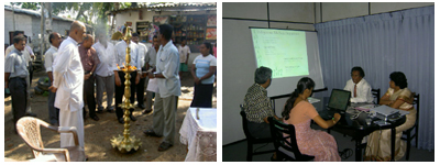
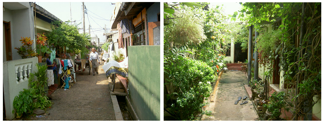
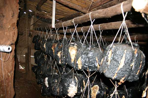
Examples of Urban Agriculture in Colombo


Project Information
The demonstration site
Two generically different sites were chosen for the demonstration:
- Upgrading of an informal settlement for which Halgaha Kumbura was selected. It is a more than 20 year old informal settlement (shanty) of about 500 families on the eastern edge of Colombo along a canal, which is currently being upgrading with the help of UN-ESCAP and the Dutch Government and Sevanatha is the executing NGO for that project.
- Use of public open land that is currently under used and therefore to be converted into community based Urban Agriculture (UA) field. For this option several sites were considered Eli House Park, Campbell Park, Ayurvedic Dispensary site at Dematagoda, and Kirulapone Herbarium. The Working Group along with Prof. Vikram Bhatt discussed advantages and disadvantages of these three sites: Eli House Park is a very prestigious and prominent facility that has declined and can be turned around if the surrounding community, which is of mixed income, can be convinced and their commitment can be assured; Sevanatha will have to do much footwork to achieve this goal. Moreover, it’s such a prestigious site that there may be some resistance for its use. Campbell Park is similar in nature, but large parts of it are already turned over to public use and public institutions –schools and play grounds – and therefore one small portion of it that is totally neglected can be chosen for the UA demostration. Most critical problem with this site is that it does not have a real community surrounding it, so we may have to work with the neighboring municipal office staff and schools teachers and students. Kirulapone Herbarium looks like the best option because of the following reason: it is next to an informal community, medical department has a working herbarium here and Sevanatha has set up a garbage-sorting center next to it. There is a history of vandals associated with this site, but with the community involvement and input from the medical department or secure fence it may be possible to address this.
Halgaha Kumbura
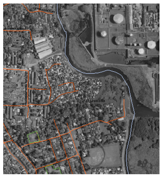 The HK upgrading project is very large (more than 500 families) so it may be necessary to divide it into several manageable blocks. Several homes along the canal are on very low laying area and therefore may have to be relocated, where to send them will have to be address. If this project is to be implemented well the canal has to be cleaned and edge repaired, to do so other powers that be will have to be mobilized. The Working Group is aware of it and has started considering ways to move on it quickly, one option that is suggested is to declare it a special project site.
Some problematics observed in HK


Ongoing upgrading process
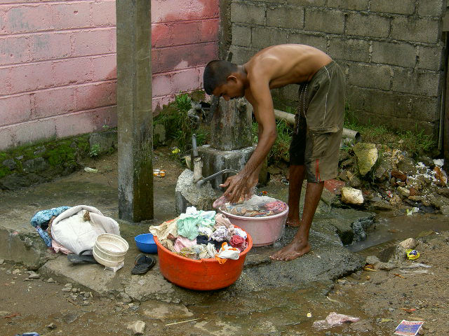

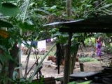
Examples of Urban Agriculture and local people

Kirulapone Herbarium
The Kirulapone Herbarium, which belongs to the Indigenous Medical Department of the Colombo Municipal Council, was selected as a demostration site for the development of a community garden project. A portion of the public open land is to be converted in a community based urban agriculture field. Next to the site there is a large informal settlement and a garbage sorting centre set up by Sevanatha that is used by the community.


Kampala, Uganda
City Team
The Local Project Working Group, formed to facilitate the process of participatory site analysis, design, implementation, documentation and systematisation, is integrated by Kampala City Council; Ministry of Agriculture, Animals, Industry and Fisheries; Ministry of Works, Housing and Communications; Makerere University; Kampala Urban Food Security, Agriculture and Livestock Coordinating Committee - KUFSALCC, Kampala District Farmers Association - KADIFA and Environmental Alert.
Kampala City Council
- Mr. John Ssebaana Kizito
His Worship the MayorMr. Muwonge Kewaza
Town ClerkMrs. Margaret S. Azuba - Local Project Leader
District Urban Agricultural OfficerMr. Richard Kabuuka
Senior Economist, Planning Unit
Ministries
- Mr. John Muwanga Musisi
Ministry of Agriculture, Animal, Industry and Fisheries.Mr. Santino Dramani
Ministry of Works, Housing and Communication
Makerere University
-
Dr. Barnabas Nawangwe
Dean of the Faculty of Technology. Makerere University.
NGOs
- Dr. George Nasinyama
Head of the Department of Veterinary Public Health, and
Representing KUFSALCC.Mr. Stephen Muhumuza
Representing KADIFAMs. Maria Kaweesa
Program Officer Food Security and Nutrition. Environmental Alert.
City Information
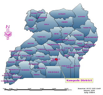
Location
Kampala is the capital City of Uganda, which is situated almost in the middle of the country covering a surface area of 195 sq. Km. Kampala city is administratively divided into five divisions namely: Central, Kawempe, Mkindye, Lubaga and Nakawa. About poverty and unemployment levels, in Kampala city 39% of the population lives in absolute poverty and 43% of the population are unemployed according to Population and Housing Census (2002).
Population
According to the Population and Housing Census (2002), Kampala's population grew at a rate of 3.9% per annum in the inter-censual period between 1991 and 2002. Also, the 2002 Census put the City population at 1.2 million people but the City has a daily transient population of about 2.3 million people. The City population growth rate is at 3.9% (average density: 51 in/ha). Urban areas in Uganda constitute 12.2% of the national population of which 41% of the urban population is in Kampala city alone.

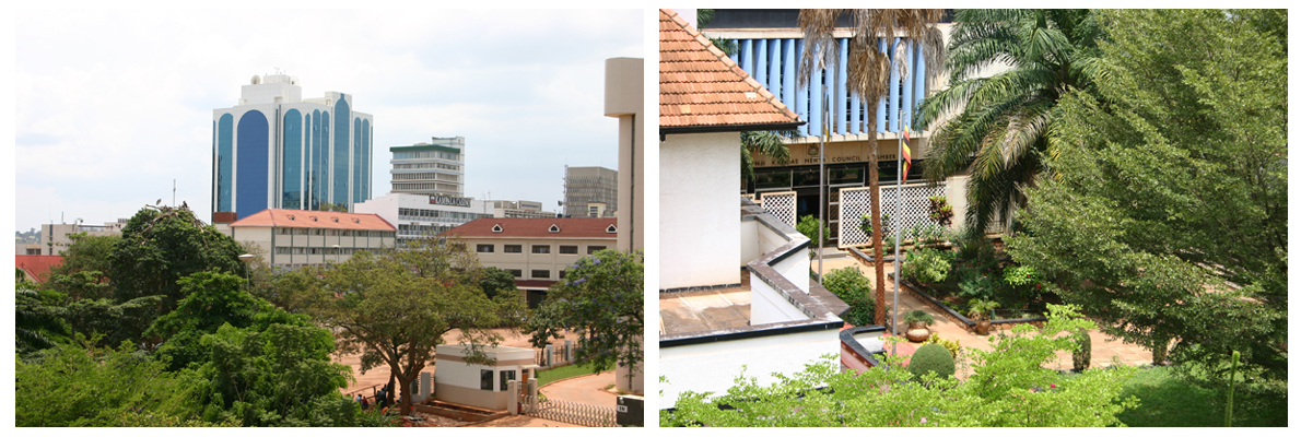
Physical Form of Kampala
The form and structure of Kampala has been largely determined by the natural pattern of flattopped hills and wide, shallow valleys on which it has been built. Kampala is also defined by the north shore of Lake Victoria and the extensive papyrus swamp, which line it. Kampala has been referred to often as “the garden city of Africa” because of its lush, green appearance, which is owed, in turn, to its pleasant climate and generous rainfall.
The evolving urban form of Kampala is attributed to the dualism, which arose between the local Kibuga and Kampala Township, or Municipality. The former was largely unplanned and unsanitary while the latter was fully planned and highly controlled. The Kibuga was a highly sophisticated urban African community and was growing as an unplanned structures and dwelling units devoid of toilets and water supply, water drainage sanitation and solid waste management systems. Kampala is therefore characterized by an imprint of unplanned settlements scattered around the city.

Additionally, land tenure has had a significant influence on physical planning and infrastructure development in Kampala City. The problem is that private landowners with titles defining rights in perpetuity are free to transfer their rights. This type of land ownership has led to the development of a lucrative land market in Kampala, which has resulted in land speculation by mailo holders creating planning problems of haphazard developments lacking basic infrastructure such as access roads, water, and sanitation.
Slum Upgrading Initiatives
The main focus of government in the housing sector has been to create an enabling environment for the private sector, NGOs and CBOs to provide houses. The condominium law is now in place and tenants are able to buy house units like flats under a common plot. The policy of Kampala City Council is to provide affordable low-cost housing to its inhabitants. In the current 2004/05 – 2006/07 Three Year Development Plan, Kampala City Council intends to embark on slum intervention programmes by acquiring land for provision of infrastructure in the slums and re-development of the slums within the vicinity of Central Business District in order for the settlements to conform to spelt out planning standards and guidelines. There is a vibrant private sector actors in housing construction who operate on commercial principles by constructing houses for sale. Some of these actors institutions include National Housing and Construction Corporation and AKRIGHT projects.
The Namuwongo Low Cost and Slum Upgrading Project was design to address the Namuwongo slum problems including lack of infrastructural service, substandard houses and economic livelihood of the poor inhabitants. The project is considered one of the most successful low-cost housing projects in the country that has enabled the local population develop their own housing because of the good enabling policies. Moreover, to address the water and sanitation problems, Kampala City Council has embarked on a 5.4 million Euro Urban sanitation Project funded by the French Development Agency, Government of Uganda and KCC aimed at improving the living conditions in the urban poor communities of Kampala’s Informal Settlements, which have been recurrently stricken by Cholera epidemics from 1997 up to date. External support has been solicited to further address the problem of sanitation through Ecological Sanitation project on pilot basis, Community Environmental Management Project. This project intends to generate nutrients that will be used in Urban Agriculture as a way of increasing food production to the farmers. The ECOSAN project is jointly funded by the Government of Uganda and SIDA.
Land Use and Urban Agriculture
The principle land use in Kampala city is dominated by residential use and small-scale agriculture. Small-scale agriculture is widely distributed in exiting residential areas as well periphery areas, which may not have been transformed into other uses. According to the 1993 urban study of Kampala, agricultural land occupied 41.2% of the land while residential occupied 32.3%, both of which formed the major uses in the city. In terms of distribution by agricultural land, Nakawa Division accupies 35% followed by Makindye with 24.5% and Kawempe by 20.6% as shown in table 1.2. These three Divisions had the largest agricultural land because they formed the bigger part of the peri-urban Kampala, which was still largely semi-rural.
| Land USe | Percentage |
|---|---|
| Residential | 32.3 |
| Agricultural | 41.2 |
| Water | 5.3 |
| Forests | 2.8 |
| Mixed-Use | 3.0 |
| Institutional | 6.4 |
| Industrial | 2.0 |
| Wetlands | 3.8 |
| Recreational | 0.9 |
| Transportation | 1.0 |
| Commercial | 1.3 |
Table 1.1 1991 Land use type by area. Source: Kampala, Urban Study Land Use Map.
| Kampala Division | % Residential | % Agriculture |
|---|---|---|
| Nakawa | 18.9 | 35 |
| Kawempe | 17.9 | 20.6 |
| Rubaga | 26.3 | 18.1 |
| Central | 13.4 | 1.7 |
| Makindye | 23.5 | 24.5 |
Note:Above information is taken from the City Dossier received for Making the Edible Landscape Project. June, 2004
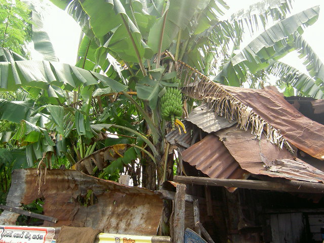
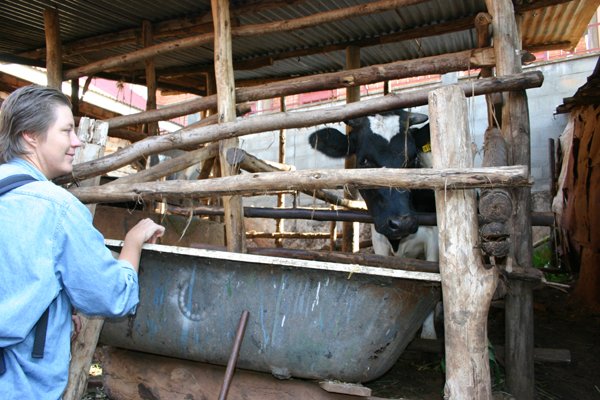
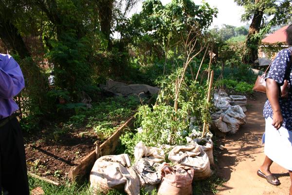
Urban Agriculture and Livestock in Kampala


Project Information
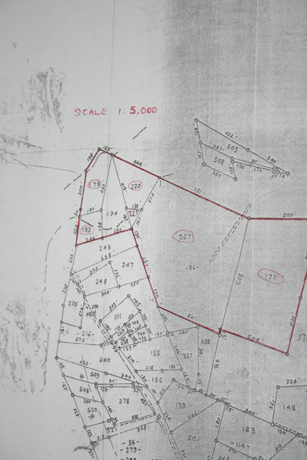
Kampala City Council has committed 16.5 acres, around 6 Ha, of land for construction of a new low-income and sustainable urban settlement integrating urban agriculture in its design and development. The project will be implemented in Kyanja Parish, Nakawa Division, North-East of Kampala City, Uganda.
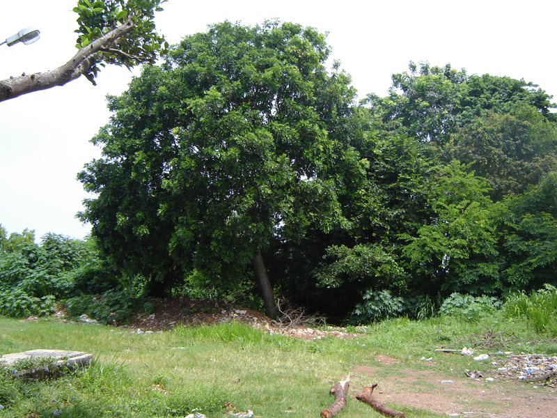
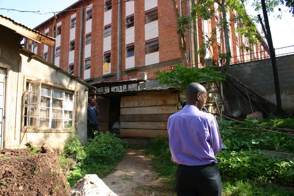
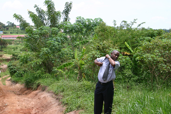
The selected site is in the north of the City, and is not covered by the satellite imagery available for the rest of the urban area. It was acquired by City Council for a solid waste landfill site, but protest by local residents led to the abandonment of this idea. The site includes a low-lying wetland area (valley) where a youth cooperative practices brick-makings, providing work for otherwise unemployed youth (what make the team feel that it would be counter-productive to close this income generating operation, taking also into consideration the bricks are said to be of good quality), and a sloping dryland area where farming is practice (mainly by women: vegetables, cassava, firewood). No constructions (houses, sheds) are found on the site. The area is owned by the City Council and no user-rights agreements are in currently place with either the cooperative or the peri-urban farmers.
The first problem to be tackled is "Who are the clients for this site?" The City team is investigating this as its number one priority. Is it the surrounding population? The brickworkers? The cultivators? Other needy people? The homeless? Who decides? How? In previous projects, KCC has had the experience of developing sites for low-income groups, and seeing them taken over by higher income people, and does not want this to happen again. The City team is looking into this matter, since no participatory design can be undertaken without clients.
The second is "What type of land-tenure and/or management structure will maximaze the potential of the site, ensure that this demostration projet will serve the interests of the poor, and be socially and culturallly acceptable?" Once the client group has been identified, the City team will consult with the group to determine the possibilies. McGill planning students are working on this range of possibilities.

Views of the selected site


Rosario, Argentina
City Team
The Local Project Working Group, formed to facilitate the process of participatory site analysis, design, implementation, documentation and systematisation, is made up of staff from the following institutions: the Municipalidad de Rosario, the Rosario National University, the Centre of Urban Environmental Studies and the Centre for Agro-ecological Production Studies.
Municipalidad de Rosario
- Mr. Miguel Lifschitz
His Worship the MayorMr. Pedro Pavicich
Secretary, Secretariat of Social PromotionMr. Antonio Lattuca
Local Project Leader and Coordinator of the Municipal Urban Agriculture ProgrammeMrs. Maria Isabel Garzia
Director of the Housing Public Service - SPVMr. Gustavo Ramos
Coordinator Molino Blanco Project - SPV
Centro de Estudios del Ambiente Urbano - Faculty of Architecture, National University of Rosario
- Ms. Laura Bracalenti
Associated Ms. Laura Lagorio
Associated
Centro de Estudios de Producciones Agroecologicas - CEPAR (Centre for Agro-ecological Production Studies)
- Mr. Edelmiro Asato
Director of the Centre for Agro-ecological Production StudiesMr. Raul Terrile
Representing CEPAR and Promotion of Urban Agriculture
City Information
Location
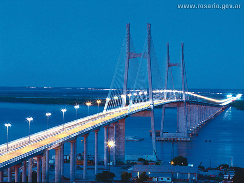
Rosario, an important municipality of the Province of Santa Fe in Argentina, is located on the right bank side of the Parana river, and covers an area of 17,869 Ha. Rosario city is divided in six descentralized districts: centre, north, north-east, west, southwest and south; the north-east and west are the bigger sectors (44 and 40 sq km respectively), and the south is the smallest (19 sq km).
Population, area and density
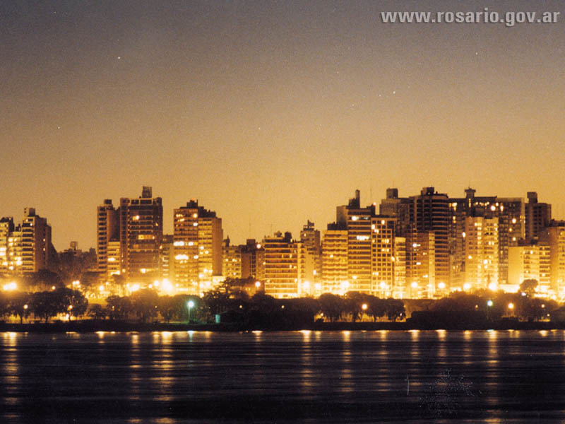
According to the 2001 National Census, Rosario had 908,875 inhabitants, 53% were women and 47% were men. 99% of the population was classified as urban, that is living in urban areas. Of the total 17,869 Ha, 12,357 Ha is considered urban while the remaining 5,512 Ha are considered rural. Additionally, the Municipality of Rosario has a density of 50.86 inhabitants per Ha. However, it is important to note the difference between urban and rural densities. While the urban density is very high reaching 73.46 inhabitants per Ha, the rural density is extremely low 0.21 inhabitants per Ha.

Slums Upgrading Initiatives
Presently, Rosario has 91 irregular settlements, housing almost 115,000 inhabitants (13% of the total population). These settlements occupy 10% of the developed land.
In 2001, the Municipality launched the program Rosario Habitat, which aims to abolish the existence of two parallel cities – the poor and the rich – through the upgrading of the city’s excluded settlements. The sites to be upgraded are chosen based on the environmental risks that they face and the potential impact of the project. The Rosario Habitat program is co-financed by the Inter-American Development Bank – 60% - and the Municipality of Rosario -40%. It is executed by Rosario’s Housing Public Service – SPV, which functions in cooperation with a Coordination Unit involving a number of municipal entities.
Land Use and Urban Agriculture
Rosario City has vacant land available that can be use for urban agriculture. In fact, the existence of a great variety of undeveloped land – private and public – offers a great opportunity to a wide range of group of urban poor to improve their economic condition by putting into use the existing underuse land. The vacant land in the Municipality of Rosario could be public or private: More than half of it belongs to the private sector, but there is still good amount of land in government hands, which can be use for urban agriculture.
Urban Agriculture in Rosario


Note:Above information is taken from the City Dossier received for Making the Edible Landscape Project. June, 2004


| Population | Inhabitants |
|---|---|
| Urban Population | 907,718 |
| Rural Population | 1,157 |
| Total Population 2001 | 908,875 |
| Projected Population 2003 | 937,000 |
Project Information
Three sites are identified: Molino Blanco South (Original), Molino Blanco West (New) and La Lagunita.
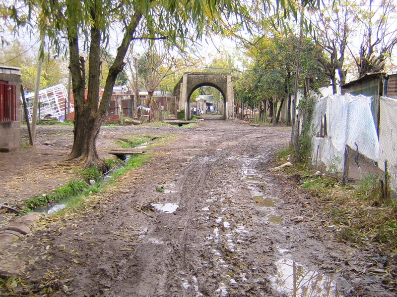
Molino Blanco South (original) situated at the southern fringe of the city limit, is a neighborhood of approximately 1000 families. This site was chosen because of its potential for doing park design and urban renewal within a planned street grid. There are current urban agriculture efforts on the site, including cooperative gardening that supply green markets sponsored by the municipality.
On the south west limit of the city, Molino Blanco West (to be built) is another neighborhood for about 224 new dwellings with potential for participating in demostration gardens and prototype housing design that would serve to inform future projects. Street grid and housing have already been done by the Servicio Público de la Vivienda (SPV) for this proposal development.
La Lagunita is a neighborhood currently undergoing urban upgrading effort as directed by the SPV, with potential for public green area design, incorporating urban agriculture features,as well as elements of urban renewal.
Molino Blanco South (Original)

The present site has an area of approximately 20 Ha which belongs to the Municipality. At the moment there is an upgrading programme coordinated by SPV intended to regularize the settlement, giving not only titles to residetns, but also providing them with the basic municipal services such as potable water, sewage, drainage, gas, electricity, paved roads, and pedestrian paths. For the purpose of this upgrading project, and as part of the Inter-American Development Bank (IDB) - sponsored "Rosario Habitat" project, 30% of the population will be displaced, who, according to the city team, are living on land that floods. However, the Rosario Municipality has arranged a new site to resettle the displaced families – the new Molino Blanco West.
The idea of the Making the Edible Landscape project in Molino Blanco South is to focus on its potential for creating a demonstration site on flood lands, plus incorporating urban agriculture features within the street grid proposed in the current upgrading program. The MCHG students have produced design charettes exploring ways to work with the community to enhance and include qualities already present in the informal settlement.
Aerial View of Molino Blanco South (Original)


Views of Molino Blanco South (Original)


Molino Blanco West
This site is meant to house the 30% of the population who will be displaced from Molino Blanco South. This new settlement will be situated in a low-density area at the south-western city limit. The selected plot is located between two main streets: Av. Provincias Unidas, which crosses the city in south-north direction, and Boulverd Segui, which crosses the city in east-west direction. The design proposal includes a Health Centre of 449 square meters plus 224 housing plots varying in size from 100 square meters to 122 square meters, smaller plots facing main streets and larger ones having inner locations. It is important to note that this proposal also provides dwellers with basic municipal services.
In Molino Blanco West the focus is on a demonstration garden and exploring ways to work on prototype housing ideas that would incorporate additional urban agricultural components. This project presents a unique challenge as the site is already planned and will be built according to pre-determined standards.
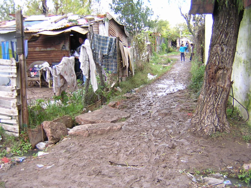
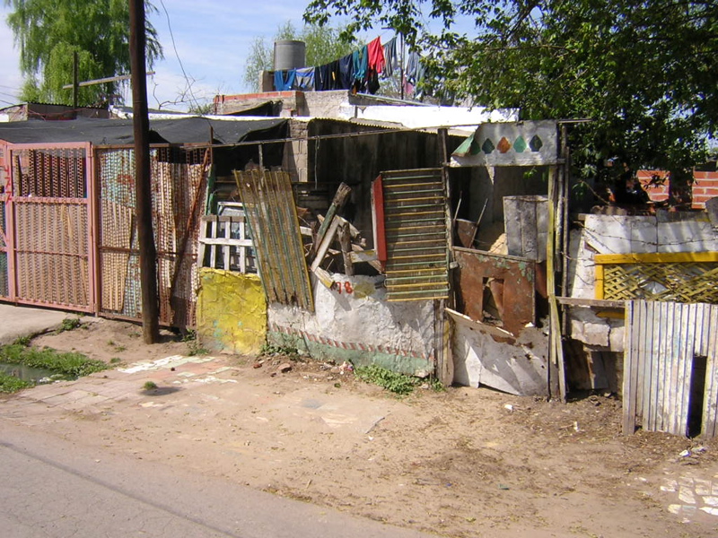
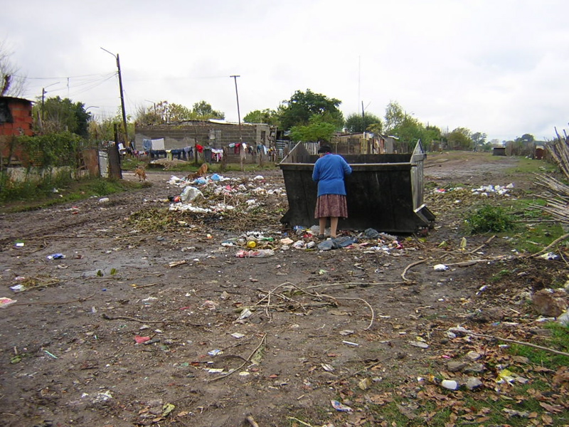
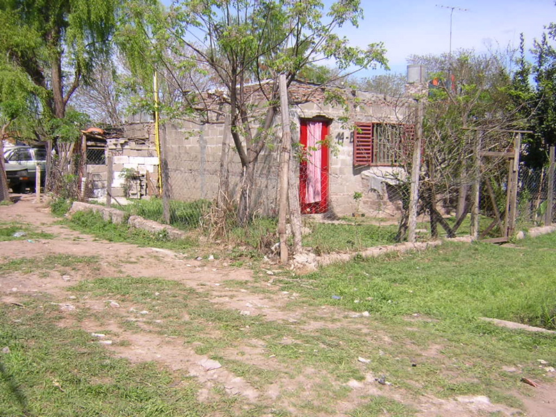
La Lagunita
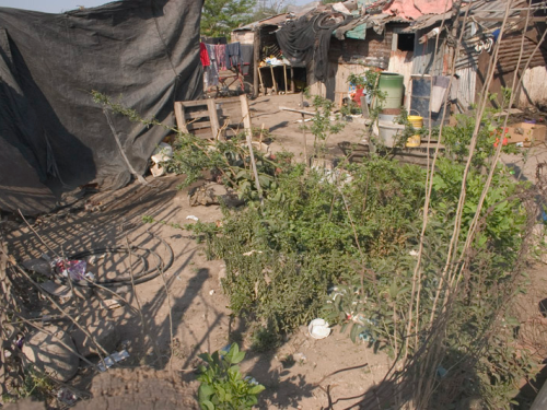
La Lagunita, a community of 253 dwellings is situated in the West District that has emerged as an axis for city’s urban development. In the 1996 Irregular Settlement’s Report, this settlement was referred in accordance to its location: “Boulevard Segui and Provincias Unidas,” but following several floods in this area in the last few years, it started to be called La Lagunita or “the lagoon.”
According to the 2003 Census, this irregular settlement had a population of 1,046 inhabitants. The housing condition in the area is diverse; ranging from well-consolidated homes, most of them located along principal streets; to recently built shanties, most of them situated in the area which floods. The main problems faced by residents of the area include: regular flooding, lack of garbage disposal and urban infrastructure. How urban agriculture can be integrated with upgrading will be the focus of our work in La Lagunita.
The Plaza Productiva (Productive Plaza) at La Lagunita was inaugurated in May, 2007. Some pictures from the preparation process and event were taken and are shown in the following PowerPoint presentations.
English version: Inauguration of Productive Plaza, La Lagunita
Spanish version: Inauguración Plaza Productiva en La Lagunita