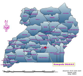
Location
Kampala is the capital City of Uganda, which is situated almost in the middle of the country covering a surface area of 195 sq. Km. Kampala city is administratively divided into five divisions namely: Central, Kawempe, Mkindye, Lubaga and Nakawa. About poverty and unemployment levels, in Kampala city 39% of the population lives in absolute poverty and 43% of the population are unemployed according to Population and Housing Census (2002).
Population
According to the Population and Housing Census (2002), Kampala's population grew at a rate of 3.9% per annum in the inter-censual period between 1991 and 2002. Also, the 2002 Census put the City population at 1.2 million people but the City has a daily transient population of about 2.3 million people. The City population growth rate is at 3.9% (average density: 51 in/ha). Urban areas in Uganda constitute 12.2% of the national population of which 41% of the urban population is in Kampala city alone.

Physical Form of Kampala
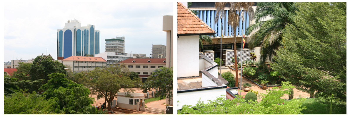
The form and structure of Kampala has been largely determined by the natural pattern of flattopped hills and wide, shallow valleys on which it has been built. Kampala is also defined by the north shore of Lake Victoria and the extensive papyrus swamp, which line it. Kampala has been referred to often as “the garden city of Africa” because of its lush, green appearance, which is owed, in turn, to its pleasant climate and generous rainfall.

The evolving urban form of Kampala is attributed to the dualism, which arose between the local Kibuga and Kampala Township, or Municipality. The former was largely unplanned and unsanitary while the latter was fully planned and highly controlled. The Kibuga was a highly sophisticated urban African community and was growing as an unplanned structures and dwelling units devoid of toilets and water supply, water drainage sanitation and solid waste management systems. Kampala is therefore characterized by an imprint of unplanned settlements scattered around the city.
Additionally, land tenure has had a significant influence on physical planning and infrastructure development in Kampala City. The problem is that private landowners with titles defining rights in perpetuity are free to transfer their rights. This type of land ownership has led to the development of a lucrative land market in Kampala, which has resulted in land speculation by mailo holders creating planning problems of haphazard developments lacking basic infrastructure such as access roads, water, and sanitation.
Slum Upgrading Initiatives
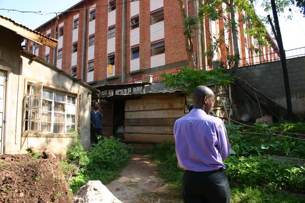
The main focus of government in the housing sector has been to create an enabling environment for the private sector, NGOs and CBOs to provide houses. The condominium law is now in place and tenants are able to buy house units like flats under a common plot. The policy of Kampala City Council is to provide affordable low-cost housing to its inhabitants. In the current 2004/05 – 2006/07 Three Year Development Plan, Kampala City Council intends to embark on slum intervention programmes by acquiring land for provision of infrastructure in the slums and re-development of the slums within the vicinity of Central Business District in order for the settlements to conform to spelt out planning standards and guidelines. There is a vibrant private sector actors in housing construction who operate on commercial principles by constructing houses for sale. Some of these actors institutions include National Housing and Construction Corporation and AKRIGHT projects.
The Namuwongo Low Cost and Slum Upgrading Project was design to address the Namuwongo slum problems including lack of infrastructural service, substandard houses and economic livelihood of the poor inhabitants. The project is considered one of the most successful low-cost housing projects in the country that has enabled the local population develop their own housing because of the good enabling policies. Moreover, to address the water and sanitation problems, Kampala City Council has embarked on a 5.4 million Euro Urban sanitation Project funded by the French Development Agency, Government of Uganda and KCC aimed at improving the living conditions in the urban poor communities of Kampala’s Informal Settlements, which have been recurrently stricken by Cholera epidemics from 1997 up to date. External support has been solicited to further address the problem of sanitation through Ecological Sanitation project on pilot basis, Community Environmental Management Project. This project intends to generate nutrients that will be used in Urban Agriculture as a way of increasing food production to the farmers. The ECOSAN project is jointly funded by the Government of Uganda and SIDA.
Land Use and Urban Agriculture
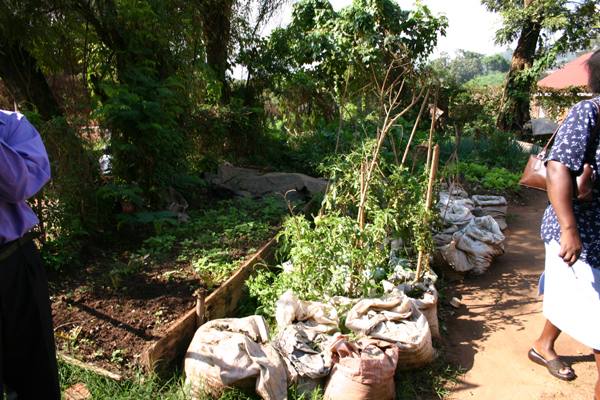
The principle land use in Kampala city is dominated by residential use and small-scale agriculture. Small-scale agriculture is widely distributed in exiting residential areas as well periphery areas, which may not have been transformed into other uses. According to the 1993 urban study of Kampala, agricultural land occupied 41.2% of the land while residential occupied 32.3%, both of which formed the major uses in the city. In terms of distribution by agricultural land, Nakawa Division accupies 35% followed by Makindye with 24.5% and Kawempe by 20.6% as shown in table 1.2. These three Divisions had the largest agricultural land because they formed the bigger part of the peri-urban Kampala, which was still largely semi-rural.
| Land USe | Percentage |
|---|---|
| Residential | 32.3 |
| Agricultural | 41.2 |
| Water | 5.3 |
| Forests | 2.8 |
| Mixed-Use | 3.0 |
| Institutional | 6.4 |
| Industrial | 2.0 |
| Wetlands | 3.8 |
| Recreational | 0.9 |
| Transportation | 1.0 |
| Commercial | 1.3 |
Table 1.1 1991 Land use type by area. Source: Kampala, Urban Study Land Use Map.
| Kampala Division | % Residential | % Agriculture |
|---|---|---|
| Nakawa | 18.9 | 35 |
| Kawempe | 17.9 | 20.6 |
| Rubaga | 26.3 | 18.1 |
| Central | 13.4 | 1.7 |
| Makindye | 23.5 | 24.5 |
Note:Above information is taken from the City Dossier received for Making the Edible Landscape Project. June, 2004
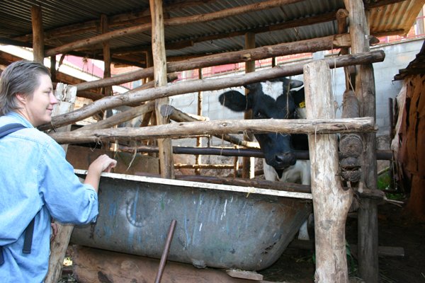
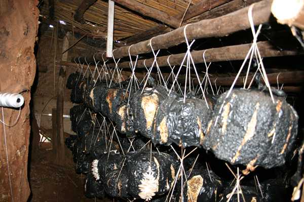
Urban Agriculture and Livestock in Kampala
| | |
    |     |